Finding our Way
/Things move a little slower in the country – and we like it that way. But, as we discussed a few weeks ago, change happens everywhere. We know our way around the mountain roads as well as we know our own houses; even the wilderness paths are no stranger to many of us. We know, and we’ve discussed here, how communities long since abandoned are still visible if you look carefully. And yet our roads do change, and have changed many times through the years and I find it a fascinating challenge to search out routes of travel at different points in time. And for that challenge, I have been on a quest for antique maps. Knowing of my hunt, my brother-in-law recently came across an 1850 map of Tennessee and he was good enough to share it with me – thank you very much Derek. Like so much historical research, this map leaves me with more questions than answers.
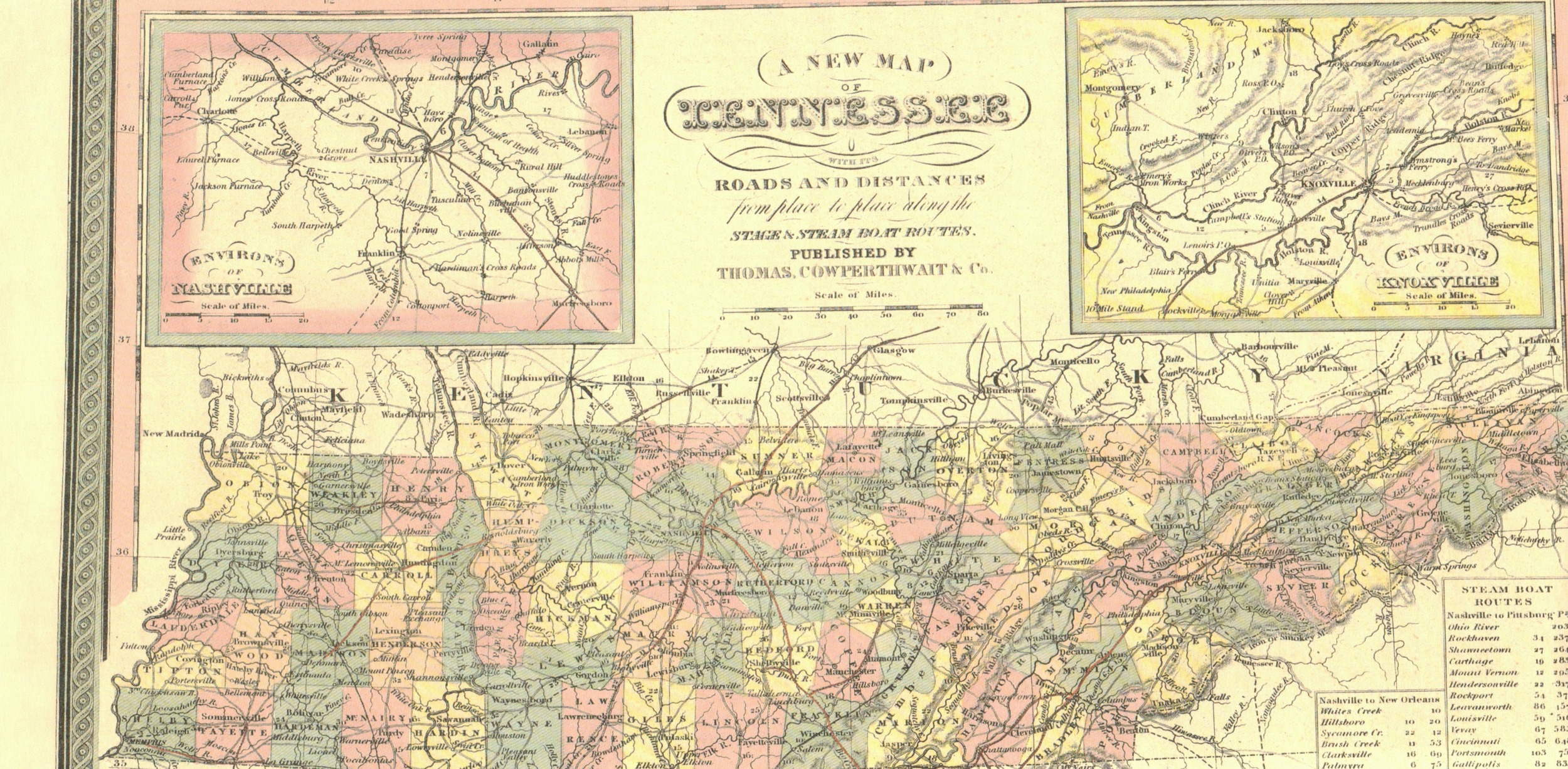
I could write pages about the differences in this map and a modern representation of the mountain and could include a long list of questions that arise from studying those differences. But what most impresses me is our shifting perspectives and focus.
This map has no road names. Of course there is no interstate system and it often appears there’s no good way to get from one major location to another. Ah, but perhaps what was major has changed; perhaps where one would most need to go was very different in the mid-nineteenth century. No railroad would cross The Plateau until 1890 so in 1850 to ride from Nashville to Knoxville, you would have to travel to Chattanooga, with a significant jaunt through Northern Alabama, and then ride northeast up to Knoxville (and I think you had to change trains a couple of times on that trip too). The roads seem to connect one little town to another with no idea of traveling great distances.
Every little creek and branch seems to be labeled on this map. That seems a little funny to us since there aren’t lots of signs along the water. I would imagine the nearest source of fresh water was a far better landmark than a road and therefore of greater importance to the map maker. Have you noticed that our modern maps, so criss-crossed with interstates, streets and lanes no longer label the small bodies of water? I even checked the highly detailed aviation charts and found only names of major waterways. Today we can pull up a satellite image of our community and zoom down to identify individual houses and yet we would never know the name of the creek running nearby.
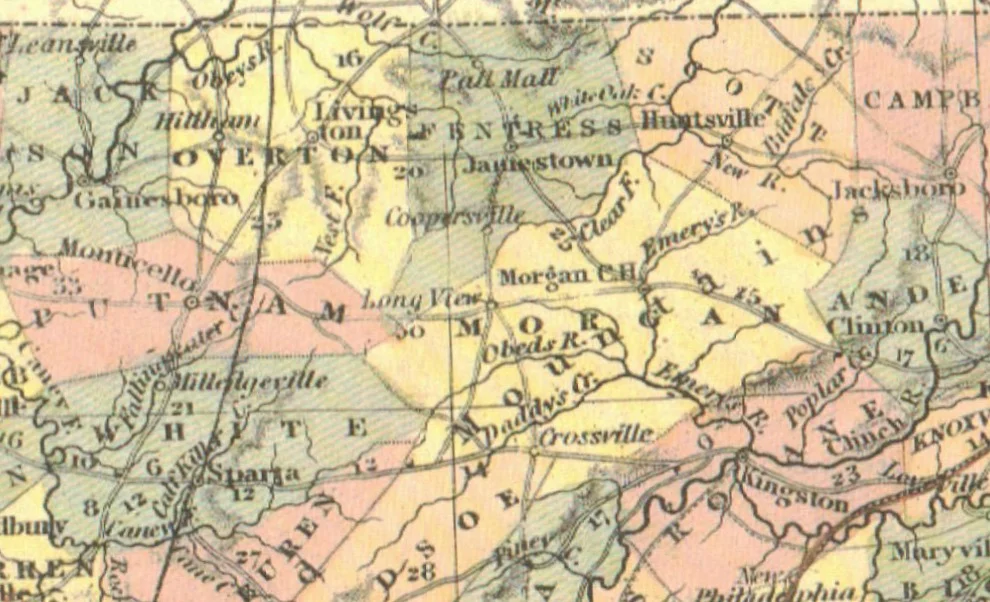
Cities have long been created or broken by the location of a railway or interstate highway and as I study this map I can’t seem to tear myself away from the names of towns that were significant enough to be labeled and those that are missing. The intersection of the north-south route from Crossville into Fentress County with the east-west route from Monticello (which is the only town noted in Putnam County) is called Long View. Now, that’s not a community I’ve even heard of and it appears to have been a good bit west of present day Clarkrange. I found a Fentress-only map from 1888 online that does show Clarkrange, but no north-south road through it. Thirty-eight years later, Long View is not mentioned, although Fentress County then showed several more communities including Boatland, Orchard Grove, Armathwaite, Barren Springs and Tinch.
As I said before, there are just more questions than answers and so my quest continues. Some of these pathways predate the European settlers so I know that until modern road-building entered the picture those routes would not have changed much for centuries. I still want to know the names those roads carried over the years. And now I want to know what happened to these lost towns!
Please take a look at the close up pictures I’m including here and let me know what you see.